
Google Maps – the great site that many people use to find directions to the nearest sushi restaurant, or navigate the shortest route to grandma’s house –is becoming more global by the day. One largely under-mapped region, South Sudan, got a big boost thanks to Google’s map-a-thon on Thursday.
The event, held jointly at the World Bank in Washington and at Google in Nairobi, brought together map makers with the technological know-how and Sudanese diaspora with knowledge of the local terrain. The end result was a refined, more detailed map that is approaching the most accurate map ever created of the region.
Scrolling over east Africa at the beginning of the event, the network of roads and markers pinpointing landmarks in Uganda and Kenya gave way to an open expanse upon crossing the virtual border into southern Sudan. Paul Munene, a geographic specialist with Google in Nairobi, explained that his team had identified the major roads, rivers, and towns, but he encouraged the southern Sudanese to get involved in filling in the details. “We estimate that we’ve only mapped about five percent of what we need to in Africa,” Munene said, adding that the southern Sudan map is one that needs the most attention.
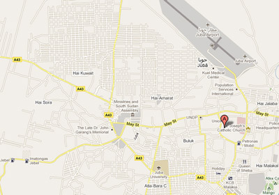
As Munene zoomed in on the capital of Juba, two southern Sudanese journalists pointed out that the memorial for the late Dr. John Garang was marked in the wrong location.
“I have noticed this many times before. We must change it,” said one older man, getting up from his seat to outline the changes with his finger on the monitor. Watching the most prominent landmark in southern Sudan shifted into its rightful place, the southern Sudanese would-be mappers quickly saw the importance of their contributions.
Google Maps is populated with great information thanks to thousands of users around the world who literally build the maps from scratch using their local knowledge. It can be used as a tool for governments, development workers, and human rights observers to help bring much needed supplies to remote areas or monitor war crimes.
UNOSAT, the U.N. satellite agency, Ushahidi, the crowd-sourced information specialists, and Google, all partners of the Enough Project in the Satellite Sentinel Project, presented at the beginning of the conference.
“This is a huge opportunity to utilize technology to help build southern Sudan into a nation state,” said Alfred Spector, vice president of engineering for Google. “We want to present southern Sudan with a birthday gift that will help it grow.”
Satellite Sentinel Project uses DigitalGlobe satellite images and analysis from UNOSAT, Harvard Humanitarian Initiative, and Enough to look for human rights violations and human security concerns in Sudan. The results are laid down on a platform built by Google Maps.
“If we use crowd-sourced information together with satellite imagery, we can solve cases of gross human rights violations,” said Francesco Pisano, head of UNOSAT.
Members of the Sudanese diaspora added their local knowledge to the master map of Sudan with the help of some of Google’s “Super Mappers” from the region. These are independent map makers, like Max Adoko, who started adding locations around his native Kampala to the map as a hobby and has now helped to create a near complete map of Uganda.
“Mapping opens up this empty space and brings us together,” he said.
Photo: Google map of Juba, capital of South Sudan