
A new report from the Satellite Sentinel Project, or SSP, confirms that Sudan and South Sudan have violated recent peace agreements by positioning troops in what is supposed to be a 12-mile (20-kilometer) demilitarized buffer zone along their contested border. Neither the joint border-verification mechanism established by both countries, nor the United Nations peacekeeping mission tasked with monitoring the demilitarized buffer zone has detected these violations.
In the report, “Broken Agreement: Violations in the Demilitarized Border Zone by Sudan and South Sudan,” DigitalGlobe satellite imagery from Heglig and Kiir Adem proves that both governments violated their obligations under the March 2013 treaty in which they agreed to implement September 2012 peace agreements.
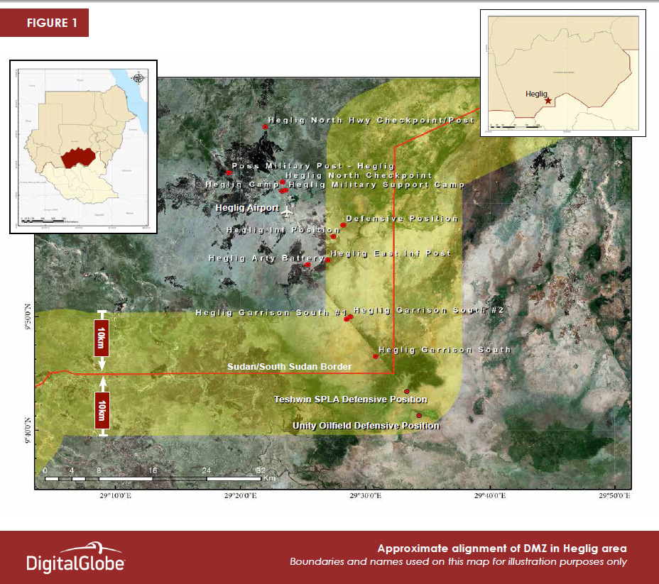
The imagery shows that both governments have taken some steps towards complying with the demilitarization agreement, including removing six tanks each from the demilitarized zone (in Heglig for Sudan, and Teshwin for South Sudan); however, the imagery also shows instances of violations on both sides. As of April 14, 2013, Sudan Armed Forces, or SAF, positioned weaponized pickup trucks in one location and maintained two defensive installations within the buffer zone near the oil-producing area of Heglig, and South Sudan maintained its own defensive position at the bridge in Kiir Adem, and appears to have established a new defensive position nearby.
Imagery in the report includes a map of the demilitarized zone, as well as before- and after- imagery of two Sudan Armed Forces garrisons, an artillery battery, and infantry position in Heglig, South Kordofan, Sudan (though claimed by South Sudan under the name Panthou), and Sudan People’s Liberation Army, or SPLA, defensive positions in Teshwin, and Kiir Adem, both located in Unity State, South Sudan.
DigitalGlobe satellite imagery confirmsa strong case that other violations have gone undetected and unverified due to the U.N. mission’s current lack of resources and force-protection capacity. SSP will continue to monitor both Sudan and South Sudan’s armed forces and their compliance with obligations to create a demilitarized buffer zone.
View or download the high-resolution DigitalGlobe satellite imagery on Flickr.